Vibes of the Virgin Islands
All inclusive — prices from Solo all inclusive — from

Ports of Call & Itinerary
7-night voyage departing Saint Thomas.
Printable Itinerary (PDF)Route Map
Vibes of the Virgin Islands
10 ports plotted · click a marker for details
Day 1
Saint Thomas , U.S. Virgin Islands
Saturday, 27/02/2027
If you fly to the 32-square-mile (83-square-km) island of St. Thomas, you land at its western end; if you arrive by cruise ship, you come into one of the world's most beautiful harbors. Either way, one of your first sights is the town of Charlotte Amalie. From the harbor you see an idyllic-looking village that spreads into the lower hills. If you were expecting a quiet hamlet with its inhabitants hanging out under palm trees, you've missed that era by about 300 years. Although other islands in the USVI developed plantation economies, St. Thomas cultivated its harbor, and it became a thriving seaport soon after it was settled by the Danish in the 1600s. The success of the naturally perfect harbor was enhanced by the fact that the Danes—who ruled St. Thomas with only a couple of short interruptions from 1666 to 1917—avoided involvement in some 100 years' worth of European wars. Denmark was the only European country with colonies in the Caribbean to stay neutral during the War of the Spanish Succession in the early 1700s. Thus, products of the Dutch, English, and French islands—sugar, cotton, and indigo—were traded through Charlotte Amalie, along with the regular shipments of slaves. When the Spanish wars ended, trade fell off, but by the end of the 1700s Europe was at war again, Denmark again remained neutral, and St. Thomas continued to prosper. Even into the 1800s, while the economies of St. Croix and St. John foundered with the market for sugarcane, St. Thomas's economy remained vigorous. This prosperity led to the development of shipyards, a well-organized banking system, and a large merchant class. In 1845 Charlotte Amalie had 101 large importing houses owned by the English, French, Germans, Haitians, Spaniards, Americans, Sephardim, and Danes. Charlotte Amalie is still one of the world's most active cruise-ship ports. On almost any day at least one and sometimes as many as eight cruise ships are tied to the docks or anchored outside the harbor. Gently rocking in the shadows of these giant floating hotels are just about every other kind of vessel imaginable: sleek sailing catamarans that will take you on a sunset cruise complete with rum punch and a Jimmy Buffett soundtrack, private megayachts for billionaires, and barnacle-bottom sloops—with laundry draped over the lifelines—that are home to world-cruising gypsies. Huge container ships pull up in Sub Base, west of the harbor, bringing in everything from breakfast cereals to tires. Anchored right along the waterfront are down-island barges that ply the waters between the Greater Antilles and the Leeward Islands, transporting goods such as refrigerators, VCRs, and disposable diapers. The waterfront road through Charlotte Amalie was once part of the harbor. Before it was filled in to build the highway, the beach came right up to the back door of the warehouses that now line the thoroughfare. Two hundred years ago those warehouses were filled with indigo, tobacco, and cotton. Today the stone buildings house silk, crystal, and diamonds. Exotic fragrances are still traded, but by island beauty queens in air-conditioned perfume palaces instead of through open market stalls. The pirates of old used St. Thomas as a base from which to raid merchant ships of every nation, though they were particularly fond of the gold- and silver-laden treasure ships heading to Spain. Pirates are still around, but today's versions use St. Thomas as a drop-off for their contraband: illegal immigrants and drugs. To explore outside Charlotte Amalie, rent a car or hire a taxi. Your rental car should come with a good map; if not, pick up the pocket-size "St. Thomas–St. John Road Map" at a tourist information center. Roads are marked with route numbers, but they're confusing and seem to switch numbers suddenly. Roads are also identified by signs bearing the St. Thomas–St. John Hotel and Tourism Association's mascot, Tommy the Starfish. More than 100 of these color-coded signs line the island's main routes. Orange signs trace the route from the airport to Red Hook, green signs identify the road from town to Magens Bay, Tommy's face on a yellow background points from Mafolie to Crown Bay through the north side, red signs lead from Smith Bay to Four Corners via Skyline Drive, and blue signs mark the route from the cruise-ship dock at Havensight to Red Hook. These color-coded routes are not marked on most visitor maps, however. Allow yourself a day to explore, especially if you want to stop to take pictures or to enjoy a light bite or refreshing swim. Most gas stations are on the island's more populated eastern end, so fill up before heading to the north side. And remember to drive on the left!
Day 2
Saint John Island , U.S. Virgin Islands
Sunday, 28/02/2027
St. John, the smallest most idyllic of the three United States Virgin Islands, is best known for its dozens of post card perfect white sand beaches, turquoise bays abounding in colourful corals & rainbows of tropical fish endless vistas of green velvet hills. Only nine miles long (14.5 kilometres) and three miles (4.8 kilometres) wide, two thirds of the island is the Virgin Islands National Park, so its spectacular beaches & untouched forests will remain that way for generations to come and remain accessible to all. There are tours of the National Park by Jeep or safari bus and hikes on spectacular trails led by Park Rangers who enrich the experience with talks on the island's history and geology as well as its flora & fauna. While it is only twenty minutes from St. Thomas by convenient hourly ferry, St. John is the peaceful, uncommercialised paradise of island fantasies. It has no high-rise buildings, cruise ship docks or airport. Visitors can obtain discounted air fares to St. Thomas. Despite its unspoiled atmosphere, it offers every facility and amenity found at major resorts.
Day 3
Virgin Gorda , British Virgin Islands
Monday, 01/03/2027
Day 4
Norman Island , British Virgin Islands
Tuesday, 02/03/2027

Day 5
Sandy Ground , Anguilla
Wednesday, 03/03/2027
Sandy Ground is a village beach on the island of Anguilla, located in the British West Indies. It benefits from a tropical climate and the warm Caribbean waters and is popular with tourists looking for a relaxing beach holiday. Sandy Ground is known by its long curved white sandy beach set against the backdrop of high cliff and a disused salt pond. It is the main port for the small island of Anguilla and its beach is popular with boat racing, beach bars, barbecues and dancing. The island of Anguilla is easy to explore with one main road running through the middle and plenty of beaches and bays to be discovered. The romantic Little Bay offers secluded coves, Junk’s Hole is home to the notorious Palm Grove barbeque, Island Harbour boasts bright coloured working fishing boats and the sands of Meads Bay host hotels for the elegant dining experience. At sunset, head to Crocus Bay and the coral cliffs for the best location on the island to watch the day’s end.

Day 5
Philipsburg , Sint Maarten (Dutch part)
Wednesday, 03/03/2027
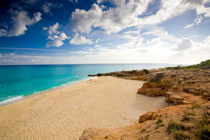
The capital of Dutch St. Maarten stretches about a mile (1½ km) along an isthmus between Great Bay and the Salt Pond and has five parallel streets. Most of the village's dozens of shops and restaurants are on Front Street, narrow and cobblestone, closest to Great Bay. It's generally congested when cruise ships are in port, because of its many duty-free shops and several casinos. Little lanes called steegjes connect Front Street with Back Street, which has fewer shops and considerably less congestion. Along the beach is a ½-mile-long (1-km-long) boardwalk with restaurants and several Wi-Fi hot spots.Wathey Square (pronounced watty) is in the heart of the village. Directly across from the square are the town hall and the courthouse, in a striking white building with cupola. The structure was built in 1793 and has served as the commander's home, a fire station, a jail, and a post office. The streets surrounding the square are lined with hotels, duty-free shops, restaurants, and cafés. The Captain Hodge Pier, just off the square, is a good spot to view Great Bay and the beach that stretches alongside.
Day 6
Philipsburg , Sint Maarten (Dutch part)
Thursday, 04/03/2027
The capital of Dutch St. Maarten stretches about a mile (1½ km) along an isthmus between Great Bay and the Salt Pond and has five parallel streets. Most of the village's dozens of shops and restaurants are on Front Street, narrow and cobblestone, closest to Great Bay. It's generally congested when cruise ships are in port, because of its many duty-free shops and several casinos. Little lanes called steegjes connect Front Street with Back Street, which has fewer shops and considerably less congestion. Along the beach is a ½-mile-long (1-km-long) boardwalk with restaurants and several Wi-Fi hot spots.Wathey Square (pronounced watty) is in the heart of the village. Directly across from the square are the town hall and the courthouse, in a striking white building with cupola. The structure was built in 1793 and has served as the commander's home, a fire station, a jail, and a post office. The streets surrounding the square are lined with hotels, duty-free shops, restaurants, and cafés. The Captain Hodge Pier, just off the square, is a good spot to view Great Bay and the beach that stretches alongside.
Day 6
Gustavia , Saint Barthélemy
Thursday, 04/03/2027
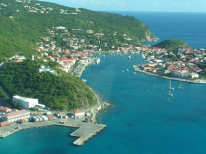
You can easily explore all of Gustavia during a two-hour stroll. Some shops close from noon to 3 or 4, so plan lunch accordingly, but stores stay open past 7 in the evening. Parking in Gustavia is a challenge, especially during vacation times. A good spot to park is rue de la République, alongside the catamarans, yachts, and sailboats.
Day 7
Gustavia , Saint Barthélemy
Friday, 05/03/2027
You can easily explore all of Gustavia during a two-hour stroll. Some shops close from noon to 3 or 4, so plan lunch accordingly, but stores stay open past 7 in the evening. Parking in Gustavia is a challenge, especially during vacation times. A good spot to park is rue de la République, alongside the catamarans, yachts, and sailboats.
Day 8
Saint Thomas , U.S. Virgin Islands
Saturday, 06/03/2027
If you fly to the 32-square-mile (83-square-km) island of St. Thomas, you land at its western end; if you arrive by cruise ship, you come into one of the world's most beautiful harbors. Either way, one of your first sights is the town of Charlotte Amalie. From the harbor you see an idyllic-looking village that spreads into the lower hills. If you were expecting a quiet hamlet with its inhabitants hanging out under palm trees, you've missed that era by about 300 years. Although other islands in the USVI developed plantation economies, St. Thomas cultivated its harbor, and it became a thriving seaport soon after it was settled by the Danish in the 1600s. The success of the naturally perfect harbor was enhanced by the fact that the Danes—who ruled St. Thomas with only a couple of short interruptions from 1666 to 1917—avoided involvement in some 100 years' worth of European wars. Denmark was the only European country with colonies in the Caribbean to stay neutral during the War of the Spanish Succession in the early 1700s. Thus, products of the Dutch, English, and French islands—sugar, cotton, and indigo—were traded through Charlotte Amalie, along with the regular shipments of slaves. When the Spanish wars ended, trade fell off, but by the end of the 1700s Europe was at war again, Denmark again remained neutral, and St. Thomas continued to prosper. Even into the 1800s, while the economies of St. Croix and St. John foundered with the market for sugarcane, St. Thomas's economy remained vigorous. This prosperity led to the development of shipyards, a well-organized banking system, and a large merchant class. In 1845 Charlotte Amalie had 101 large importing houses owned by the English, French, Germans, Haitians, Spaniards, Americans, Sephardim, and Danes. Charlotte Amalie is still one of the world's most active cruise-ship ports. On almost any day at least one and sometimes as many as eight cruise ships are tied to the docks or anchored outside the harbor. Gently rocking in the shadows of these giant floating hotels are just about every other kind of vessel imaginable: sleek sailing catamarans that will take you on a sunset cruise complete with rum punch and a Jimmy Buffett soundtrack, private megayachts for billionaires, and barnacle-bottom sloops—with laundry draped over the lifelines—that are home to world-cruising gypsies. Huge container ships pull up in Sub Base, west of the harbor, bringing in everything from breakfast cereals to tires. Anchored right along the waterfront are down-island barges that ply the waters between the Greater Antilles and the Leeward Islands, transporting goods such as refrigerators, VCRs, and disposable diapers. The waterfront road through Charlotte Amalie was once part of the harbor. Before it was filled in to build the highway, the beach came right up to the back door of the warehouses that now line the thoroughfare. Two hundred years ago those warehouses were filled with indigo, tobacco, and cotton. Today the stone buildings house silk, crystal, and diamonds. Exotic fragrances are still traded, but by island beauty queens in air-conditioned perfume palaces instead of through open market stalls. The pirates of old used St. Thomas as a base from which to raid merchant ships of every nation, though they were particularly fond of the gold- and silver-laden treasure ships heading to Spain. Pirates are still around, but today's versions use St. Thomas as a drop-off for their contraband: illegal immigrants and drugs. To explore outside Charlotte Amalie, rent a car or hire a taxi. Your rental car should come with a good map; if not, pick up the pocket-size "St. Thomas–St. John Road Map" at a tourist information center. Roads are marked with route numbers, but they're confusing and seem to switch numbers suddenly. Roads are also identified by signs bearing the St. Thomas–St. John Hotel and Tourism Association's mascot, Tommy the Starfish. More than 100 of these color-coded signs line the island's main routes. Orange signs trace the route from the airport to Red Hook, green signs identify the road from town to Magens Bay, Tommy's face on a yellow background points from Mafolie to Crown Bay through the north side, red signs lead from Smith Bay to Four Corners via Skyline Drive, and blue signs mark the route from the cruise-ship dock at Havensight to Red Hook. These color-coded routes are not marked on most visitor maps, however. Allow yourself a day to explore, especially if you want to stop to take pictures or to enjoy a light bite or refreshing swim. Most gas stations are on the island's more populated eastern end, so fill up before heading to the north side. And remember to drive on the left!
Room Type & Prices
All all inclusive prices per person based on double occupancy. Solo traveller prices — single occupancy. Contact our cruise experts for the latest availability and best fares.
Earlybird Discount
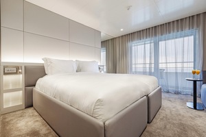
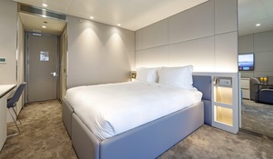
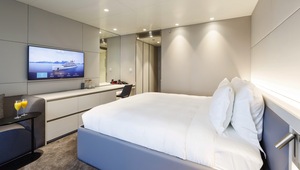
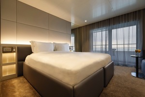
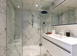
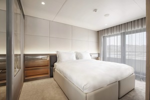
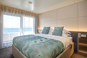
Balcony Suite
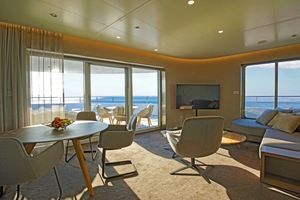
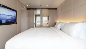
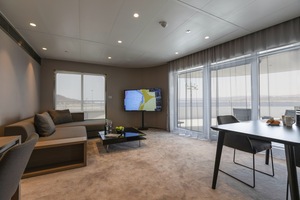
285–306 sqft · Up to 3 guests
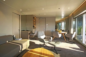

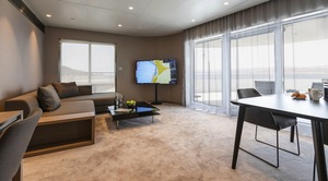
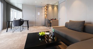
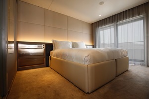
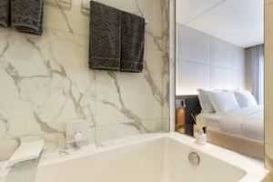
Owner's Suite
1162–1182 sqft · Up to 4 guests
More Departures
7 nights
Danube Delights
16/10/2026
Solo From
£5,221
From
£2,786
10 nights
Danube Delights & Classic Prague
16/10/2026
Solo From
£5,096
From
£2,761
7 nights
Autumn Sensations of Lyon & Provence
17/10/2026
Solo From
£6,696
From
£3,523
7 nights
Jewels of the Rhine
17/10/2026
Solo From
£3,702
From
£2,625
14 nights
Splendours of Europe
17/10/2026
Solo From
£7,742
From
£4,219
14 nights
Splendours of Europe
17/10/2026
Solo From
£7,742
From
£4,219
Your Ship
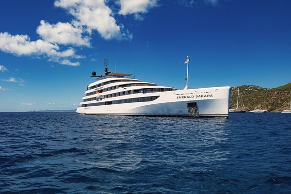
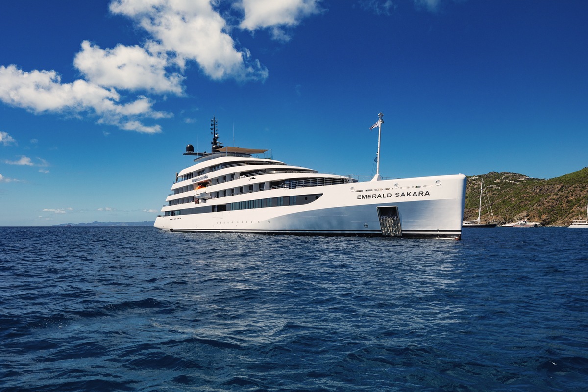
Emerald Sakara
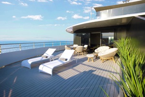
Emerald Sakara, the stunning sister to Emerald Azzurra launched in 2023, marking the next chapter in luxury yacht cruising. Hosting just 100 guests, she mirrors Emerald Azzurra’s expansive open decks, serene wellness spaces, and cutting-edge Marina Platform, delivering an exceptional experience at sea.